فایل:Anerley, Anerley Road - geograph.org.uk - 1745779.jpg

سیناق گؤستریشی اؤلچوسو: ۸۰۰ × ۵۳۳ پیکسل. آیری کیفیتلر: ۳۲۰ × ۲۱۳ پیکسل | ۶۴۰ × ۴۲۷ پیکسل | ۱٬۰۲۴ × ۶۸۳ پیکسل | ۱٬۲۸۰ × ۸۵۳ پیکسل | ۲٬۵۶۰ × ۱٬۷۰۷ پیکسل | ۳٬۴۵۶ × ۲٬۳۰۴ پیکسل.
فایلین اصلی (۳٬۴۵۶ × ۲٬۳۰۴ پیکسل, فایل اؤلچوسو: ۵ مگابایت, MIME نوعو: image/jpeg)
قیساسی
| آچیقلاما |
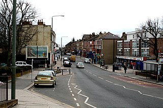
English: Anerley: Anerley Road This unremarkable road, which is part of the A214, runs from an end-on junction with Anerley Hill at the 'Paxton Arms', for almost a mile southeast to its crossroads with the A213, where used to stand, but is no more, a large public house known as the 'Robin Hood', see 39395. This pub was a local point of reference, so that certain buses would display 'Anerley, Robin Hood' on their blinds. The origin of the district name Anerley is of some interest. Many, many years ago, before railways or even canals, a certain Scotsman built a farm here. He could see no other habitation from his farm, so he gave it the name 'Aneley' - Scottish for 'lonely'. Not so aneley now. |
| تاریخ | |
| قایناق | From geograph.org.uk |
| یازار | Dr Neil Clifton |
| موجَویز (required by the license) | Dr Neil Clifton / Anerley: Anerley Road / |
| مختصات دوربین | | محل قرارگیری این نگاره و سایر نگارهها در: نقشهٔ شهری باز |
|---|
_heading:135.00&language=azb)
| مختصات شیء | | محل قرارگیری این نگاره و سایر نگارهها در: نقشهٔ شهری باز |
|---|
_heading:135.00&language=azb)
لیسانس

|
این نگاره از مجموعهٔ پروژهٔ Geograph گرفته شدهاست. این صفحهٔ عکسها را در وبگاه Geograph برای جزئیات تماس با عکاس ببینید. حق تکثیر این تصویر به Dr Neil Clifton تعلق دارد و برای استفادهٔ مجدد تحت Creative Commons Attribution-ShareAlike 2.0 مجوزدهی شدهاست.
|
این پرونده با اجازهنامهٔ کریتیو کامانز Attribution-Share Alike 2.0 عمومی منتشر شده است.
موجَویز: Dr Neil Clifton
- سیزین ایجازه نیز وار دیر:
- بؤلۆشمک – اثرین کپی، پایلاشماق و چاتدیرماسی اوچون
- تلفیق ائت – اثرین توتوشدورماسی اوچون
- آشاغی داکی شرایطله:
- تخصیص – اثری مؤلف و یا لیسئنزییالی طرفیندن گؤستریلدیی کیمی ایستیناد ائتملیسینیز (آنجاق سنی دستکلدیینی و یا اثردن ایستیفاده ائتمیینیزی تکلیف ائتمملیسینیز).
- بیرگه پایلاشیم – اگر بو اثرده دَییشدیرمه، چؤندرمه، یا دا کؤکدن دوزلتمه ائتسز، اله گلمیش اثری یالنیز بیر ائشیت یوخسا اوخشار بیر مجوزین آلتیندا یاییملایابیلرسینیز .
فايل گئچمیشی
فايلین اولکی وئرسیياسینی گؤرمک اۆچون گۆن/تاریخ بؤلمهسیندهکی تاریخلری تێقلايین.
| تاریخ/واخت | کیچیک عکس | اؤلچولر | ایشلدن | باخیش | |
|---|---|---|---|---|---|
| ایندیکی | ۵ مارس ۲۰۱۱، ساعت ۱۸:۰۸ | | ۳٬۴۵۶ در ۲٬۳۰۴ (۵ مگابایت) | GeographBot | == {{int:filedesc}} == {{Information |description={{en|1=Anerley: Anerley Road This unremarkable road, which is part of the A214, runs from an end-on junction with Anerley Hill at the 'Paxton Arms', for almost a mile southeast to its crossroads with the |
فايل ایشلدمهسی
آشاغیداکی صحیفه بو فایلا باغلانیر
فایلین باشاباش ایشلنیلمهسی
بو فایل آشاغی داکی آیری ویکی لرده ایشلَنیر: