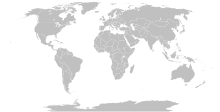
فایل:BlankMap-World-Compact.svg

حجم پیشنمایش PNG این SVG file:۸۰۰ × ۳۵۴ پیکسل آیری کیفیتلر: ۳۲۰ × ۱۴۲ پیکسل | ۶۴۰ × ۲۸۴ پیکسل | ۱٬۰۲۴ × ۴۵۴ پیکسل | ۱٬۲۸۰ × ۵۶۷ پیکسل | ۲٬۵۶۰ × ۱٬۱۳۴ پیکسل.
فایلین اصلی (SVG فایلی، ۲٬۵۶۰ × ۱٬۱۳۴ پیکسئل، فایلین اؤلچوسو: ۱٫۰۱ مگابایت)
فايل گئچمیشی
فايلین اولکی وئرسیياسینی گؤرمک اۆچون گۆن/تاریخ بؤلمهسیندهکی تاریخلری تێقلايین.
| تاریخ/واخت | کیچیک عکس | اؤلچولر | ایشلدن | باخیش | |
|---|---|---|---|---|---|
| ایندیکی | ۱۱ اوْکتوبر ۲۰۲۳، ساعت ۱۲:۵۶ |  | ۲٬۵۶۰ در ۱٬۱۳۴ (۱٫۰۱ مگابایت) | Yodin | Latest version is minified, and no longer easily text-editable; Reverted to version as of 14:50, 16 March 2019 (UTC) |
| ۱۰ اوْکتوبر ۲۰۲۳، ساعت ۱۷:۰۷ |  | ۵۱۲ در ۲۲۷ (۷۵۴ کیلوبایت) | Ahmed0arafat | fix african countries count to 54 | |
| ۱۶ مارس ۲۰۱۹، ساعت ۱۴:۵۰ |  | ۲٬۵۶۰ در ۱٬۱۳۴ (۱٫۰۱ مگابایت) | Gomoloko | I corrected Transnistria tag showing in a larger area than it should, instead of Moldova | |
| ۱۱ مارس ۲۰۱۹، ساعت ۰۷:۰۹ |  | ۲٬۵۶۰ در ۱٬۱۳۴ (۱٫۰۱ مگابایت) | Gomoloko | I corrected West Bank (State of Palestine) name not showing when the mouse was over the area | |
| ۱۱ مارس ۲۰۱۹، ساعت ۰۰:۵۱ |  | ۲٬۵۶۰ در ۱٬۱۳۴ (۱٫۰۱ مگابایت) | Gomoloko | last change :) Gambia, Republic of The | |
| ۱۱ مارس ۲۰۱۹، ساعت ۰۰:۲۵ |  | ۲٬۵۶۰ در ۱٬۱۳۴ (۱٫۰۱ مگابایت) | Gomoloko | I reverted all changes and made only the following according to www.un.org : North Macedonia, United States of America, Eswatini, United Kingdom of Great Britain and Northern Ireland, Cabo Verde | |
| ۱۰ مارس ۲۰۱۹، ساعت ۲۱:۰۲ |  | ۲٬۵۶۰ در ۱٬۱۳۴ (۱٫۰۱ مگابایت) | Gomoloko | North Macedonia, Republic of _ Congo, Democratic Republic of the _ Kyrgyz Republic _ Vietnam, Socialist Republic of _ China, People's Republic of _ United States of America _ Eswatini, Kingdom of _ Cabo Verde, Republic of | |
| ۱۰ فوریه ۲۰۱۸، ساعت ۲۱:۵۵ |  | ۲٬۵۶۰ در ۱٬۱۳۴ (۱٫۰۱ مگابایت) | Fibonacci | Updated the map with land and water outlines from the original. | |
| ۲۵ آقوست ۲۰۱۲، ساعت ۱۹:۳۲ |  | ۹۴۰ در ۴۱۵ (۱٫۴۵ مگابایت) | Kpengboy | Reverted to version as of 16:35, 13 February 2012 (there's a reason the code wasn't "optimised". re-add transparency if you think it's better) | |
| ۱۷ آوریل ۲۰۱۲، ساعت ۲۰:۵۷ |  | ۹۴۰ در ۴۱۵ (۸۱۸ کیلوبایت) | Fred the Oyster | Corrected my faux pas with the upper and lower margins |
فايل ایشلدمهسی
بو فایلا هئچ بیر صفحهیه باغلانماییب.
فایلین باشاباش ایشلنیلمهسی
بو فایل آشاغی داکی آیری ویکی لرده ایشلَنیر:
- de.wikipedia.org-ده ایشلنمهسی
- en.wikipedia.org-ده ایشلنمهسی
- fr.wikipedia.org-ده ایشلنمهسی
- zh.wikipedia.org-ده ایشلنمهسی


