فایل:USA Hawaii relief location map.svg

فایلین اصلی (SVG فایلی، ۱٬۴۴۱ × ۹۳۵ پیکسئل، فایلین اؤلچوسو: ۳۱۷ کیلوبایت)
قیساسی
| آچیقلاما |
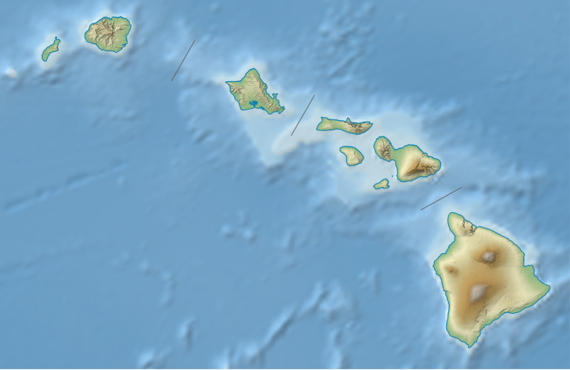
Quadratische Plattkarte, N-S-Streckung 107 %. Geographische Begrenzung der Karte:
Equirectangular projection, N/S stretching 107 %. Geographic limits of the map:
|
| تاریخ | |
| قایناق |
own work, using
|
| یازار | NordNordWest |
| آیری نوسخهلر |
|


|
این نقشه در Kartenwerkstatt "(آزمایشگاه نقشه)" آلمانی ساخته یا بهبود یافته است. همچنین می توانید نقشه هایی را برای بهبود پیشنهاد دهید.
|
لیسانس
Usage of this file with:

explanatory notes: Legally binding is only the full legalcode. For a free usage I recommend to respect the following licence conditions:
1. Provide my name as given above: NordNordWest,
2. a copy of, or the URI for, the applicable license: https://creativecommons.org/licenses/by-sa/3.0/de/legalcode,
3. the title of the work,
4. in the case of an adaptation, a credit identifying the use of the work in the adaptation.
This license and the rights granted hereunder will terminate automatically upon any breach by you of the terms of this license. Any of the above conditions can be waived if you get permission from the copyright holder. If you have questions or wish differing conditions, please contact me through nnwest or my discussion page ![]() t-online.de
t-online.de
- سیزین ایجازه نیز وار دیر:
- بؤلۆشمک – اثرین کپی، پایلاشماق و چاتدیرماسی اوچون
- تلفیق ائت – اثرین توتوشدورماسی اوچون
- آشاغی داکی شرایطله:
- تخصیص – اثری مؤلف و یا لیسئنزییالی طرفیندن گؤستریلدیی کیمی ایستیناد ائتملیسینیز (آنجاق سنی دستکلدیینی و یا اثردن ایستیفاده ائتمیینیزی تکلیف ائتمملیسینیز).
- بیرگه پایلاشیم – اگر بو اثرده دَییشدیرمه، چؤندرمه، یا دا کؤکدن دوزلتمه ائتسز، اله گلمیش اثری یالنیز بیر ائشیت یوخسا اوخشار بیر مجوزین آلتیندا یاییملایابیلرسینیز .

فايل گئچمیشی
فايلین اولکی وئرسیياسینی گؤرمک اۆچون گۆن/تاریخ بؤلمهسیندهکی تاریخلری تێقلايین.
| تاریخ/واخت | کیچیک عکس | اؤلچولر | ایشلدن | باخیش | |
|---|---|---|---|---|---|
| ایندیکی | ۳ آقوست ۲۰۱۳، ساعت ۱۹:۲۲ | | ۱٬۴۴۱ در ۹۳۵ (۳۱۷ کیلوبایت) | NordNordWest | brighter |
| ۳ آقوست ۲۰۱۳، ساعت ۱۹:۱۰ |  | ۱٬۴۴۱ در ۹۳۵ (۳۳۱ کیلوبایت) | NordNordWest | {{Information |Description= {{de|Positionskarte von Hawaii, USA}} Quadratische Plattkarte, N-S-Streckung 107 %. Geographische Begrenzung der Karte: * N: 22.4° N * S: 18.7° N * W: 160.7° W * O: 154.6° W {{en|Location map o... |
فايل ایشلدمهسی
آشاغیداکی صحیفه بو فایلا باغلانیر
فایلین باشاباش ایشلنیلمهسی
بو فایل آشاغی داکی آیری ویکی لرده ایشلَنیر:
- ar.wikipedia.org-ده ایشلنمهسی
- ast.wikipedia.org-ده ایشلنمهسی
- az.wikipedia.org-ده ایشلنمهسی
- bg.wikipedia.org-ده ایشلنمهسی
- bn.wikipedia.org-ده ایشلنمهسی
- ca.wikipedia.org-ده ایشلنمهسی
- ceb.wikipedia.org-ده ایشلنمهسی
- ce.wikipedia.org-ده ایشلنمهسی
- ckb.wikipedia.org-ده ایشلنمهسی
- cs.wikipedia.org-ده ایشلنمهسی
- de.wikipedia.org-ده ایشلنمهسی
بو فایلینسراسری ایستفاده لرینه باخین.