فایل:WielkoPolska epoki Piastowskiej.jpg

فایلین اصلی (۴٬۰۷۵ × ۳٬۶۱۳ پیکسل, فایل اؤلچوسو: ۱۰٫۴۶ مگابایت, MIME نوعو: image/jpeg)
قیساسی
| آچیقلاما |
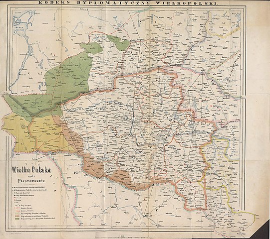
English: Historical map of Greater Poland (Middle Ages) made by Dr. T. Szulc and included in the 4th volume of Codex diplomaticus Maioris Poloniae
Polski: Historyczna mapa Wielkopolski w epoce piastowskiej wykonana przez Dr. T. Szulca i zamieszczona w 4. tomie Kodeksu dyplomatycznego Wielkopolski |
| تاریخ | |
| قایناق | Kodeks dyplomatyczny Wielkopolski obejmujący dokumenta tak już drukowane, jak dotąd nie ogłoszone, sięgające do roku 1400, t.4, Poznań 1881 - Mapa Wielkopolski |
| یازار | Dr. T. Szulc |
| آیری نوسخهلر | آثار انشقاقی از این پرونده: Land given up to Silesian dukes (Dr. T. Szulc).jpg |
.jpg)
لیسانس
|
این اثر در کشورهایی و مناطقی که مدت زمان حق تکثیر، عمر پدیدآورنده بعلاوه 70 سال یا کمتر بعد از مرگ او است، در مالکیت عمومی قرار دارد.
| |
| این پرونده تحت قانون حق تکثیر محدودیت آزاد منتشر شده که شامل تمامی حقوق مربوطه و حقوق نزدیک به آن میشود. | |
فايل گئچمیشی
فايلین اولکی وئرسیياسینی گؤرمک اۆچون گۆن/تاریخ بؤلمهسیندهکی تاریخلری تێقلايین.
| تاریخ/واخت | کیچیک عکس | اؤلچولر | ایشلدن | باخیش | |
|---|---|---|---|---|---|
| ایندیکی | ۲۲ ژوئن ۲۰۰۹، ساعت ۱۵:۲۸ | | ۴٬۰۷۵ در ۳٬۶۱۳ (۱۰٫۴۶ مگابایت) | Paelius | {{Information |Description={{en|1=Historical map of Greater Poland (Middle Ages) made by Dr. T. Szulc and included in the 4th volume of Codex diplomaticus Maioris Poloniae}} {{pl|1=Historyczna mapa Wielkopolski w epoce piastowskiej wykonana przez Dr. T. S |
فايل ایشلدمهسی
آشاغیداکی صحیفه بو فایلا باغلانیر
فایلین باشاباش ایشلنیلمهسی
بو فایل آشاغی داکی آیری ویکی لرده ایشلَنیر:
- bg.wikipedia.org-ده ایشلنمهسی
- ca.wikipedia.org-ده ایشلنمهسی
- cs.wikipedia.org-ده ایشلنمهسی
- da.wikipedia.org-ده ایشلنمهسی
- de.wikipedia.org-ده ایشلنمهسی
- dsb.wikipedia.org-ده ایشلنمهسی
- el.wikipedia.org-ده ایشلنمهسی
- en.wikipedia.org-ده ایشلنمهسی
- es.wikipedia.org-ده ایشلنمهسی
- et.wikipedia.org-ده ایشلنمهسی
- fa.wikipedia.org-ده ایشلنمهسی
- hr.wikipedia.org-ده ایشلنمهسی
- mk.wikipedia.org-ده ایشلنمهسی
- nl.wikipedia.org-ده ایشلنمهسی
- no.wikipedia.org-ده ایشلنمهسی
- pl.wikipedia.org-ده ایشلنمهسی
- Piła (miasto)
- Głogów
- Wielkopolska
- Jarocin
- Sieraków
- Władysław Odonic
- Bolesław Pobożny
- Lubusz
- Chwarszczany
- Nowa Marchia
- Międzyrzecz
- Świebodzin
- Wschowa
- Łagów (powiat świebodziński)
- Powiat wałecki
- Powiat górowski
- Powiat milicki
- Powiat międzyrzecki
- Międzychód
- Odolanów
- Opole (średniowiecze)
- Osieczna
- Buk (miasto)
- Zamek w Międzyrzeczu
- Kościan
بو فایلینسراسری ایستفاده لرینه باخین.