قورلیتسه
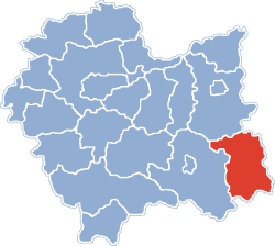
قورلیتسه (لهیستانجا: Gorlice County) لهیستاندا بیر یاشاییش منطقهسیدیر 967.36 کیلومتر موربّع ساحهسی وار. و کیچیک لهیستان اوستانیندا یئرلشیر.
Gorlice County
Powiat gorlicki | |
|---|---|
 Location within the voivodeship | |
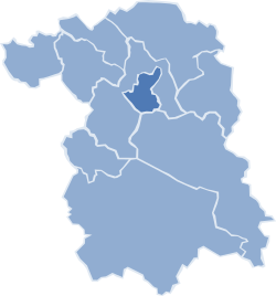
 Division into gminas | |
| موختصاتلار (Gorlice): 49°39′N 21°10′E / 49.650°N 21.167°Eموختصات: 49°39′N 21°10′E / 49.650°N 21.167°E | |
| اؤلکه | |
| Voivodeship | کیچیک لهیستان اوستانی |
| Seat | Gorlice |
| Gminas | |
| اراضی | |
| • Total | ۹۶۷٫۳۶ km2 (۳۷۳٫۵۰ sq mi) |
| جمعیت (2006) | |
| • Total | ۱۰۶٬۵۴۰ |
| • سیخلیق | ۱۱۰/km2 (۲۹۰/sq mi) |
| • شهر | ۳۶٬۱۴۲ |
| • Rural | ۷۰٬۳۹۸ |
| Car plates | KGR |
| وئب سایت | http://www.powiat.gorlice.pl |
Gorlice | |
|---|---|
| موختصاتلار: 49°39′N 21°10′E / 49.650°N 21.167°E | |
| اؤلکه | |
| Voivodeship | کیچیک لهیستان اوستانی |
| County | Gorlice County |
| Gmina | Gorlice (urban gmina) |
| ایداره | |
| • Mayor | Rafał Kukla |
| اراضی | |
| • جمع | ۲۳٫۵۶ km2 (۹٫۱۰ sq mi) |
| جمعیت (2008) | |
| • جمع | ۲۹٬۵۰۰ |
| • سیخلیق | ۱٬۳۰۰/km2 (۳٬۲۰۰/sq mi) |
| ساعات قورشاغی | یوتیسی +1 (CET) |
| • یای (DST) | یوتیسی +2 (CEST) |
| Postal code | 38-300 and 38-320 |
| Car plates | KGR |
| وئب سایت | http://www.gorlice.pl |
بیرده باخ
دَییشدیرقایناقلار
دَییشدیراینگیلیسجه ویکیپدیاسینین ایشلدنلری طرفیندن یارانمیش«Gorlice»، مقالهسیندن گؤتورولوبدور.( ۱۲ ژوئن ۲۰۱۸ تاریخینده یوْخلانیلیبدیر).
| بو لهیستان ایله باغلی مقاله، بیر قارالاما مقاله دیر. بونو گئنیشلندیرمکله ویکیپدیایا کؤمک ائده بیلرسینیز. |


