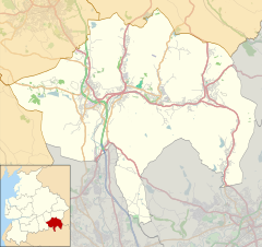
بیکاپ
بیکاپ (اینگیلیسیجه: Bacup) بریتانیادا بیر یاشاییش منطقهسیدیر سوْن نۆفوس تخمینلرینه گؤره 13323 نفر دیر. بۇ شهر اینگیلیس اؤلکهسینده یئرلشیب.
| Bacup | |
|---|---|
 Yorkshire Street, Bacup's main thoroughfare | |
| جمعیت | ۱۳٬۳۲۳ (2011 Census) |
| OS grid reference | SD868231 |
| • لندن | ۱۷۵ mi (۲۸۲ km) SSE |
| District | |
| Shire county | |
| Region | |
| اؤلکه | England |
| موستقیل دوولت | United Kingdom |
| Post town | BACUP |
| Postcode district | OL13 |
| تیلفون کودو | 01706 |
| Ambulance | North West |
| UK Parliament | |
گؤرونتولر
دَییشدیربیرده باخ
دَییشدیرقایناقلار
دَییشدیر| بو شهرلر ایله باغلی مقاله، بیر قارالاما مقاله دیر. بونو گئنیشلندیرمکله ویکیپدیایا کؤمک ائده بیلرسینیز. |
